The water quality of the Dniester River has become the subject of a research project carried out at the Technical University of Moldova. Nichita Cătărău, a student at the Faculty of Construction, Geodesy and Cadastre, analysed the condition of the river’s water using satellite imagery and machine learning methods.
The student’s paper is titled “Monitoring the Water Quality of the Dniester River Using Sentinel-2 Remote Sensing and Machine Learning Methods.” The research is guided by a practical question: how can the water quality of the Dniester be monitored more effectively? The river is the main source of drinking water for the Republic of Moldova, and more than 70% of the population depends on it. For this reason, regular monitoring is necessary in order to detect changes that may affect water quality at an early stage.
Nichita Cătărău, student at FCGC, explains why satellite-based analysis can complement traditional monitoring of the Dniester:
“Field monitoring is necessary, but along a river of approximately 660 kilometres, it is difficult to collect data across the entire course at the same time. With satellite imagery, we can regularly observe the entire course of the Dniester and identify more quickly the areas where changes occur.”
The student proposes a complementary monitoring method: using Sentinel-2 satellite imagery, which is available free of charge and has a resolution of 10 metres. The satellite revisits the same area every five days. This makes it possible to analyse the water periodically, across large areas and within the same timeframe.
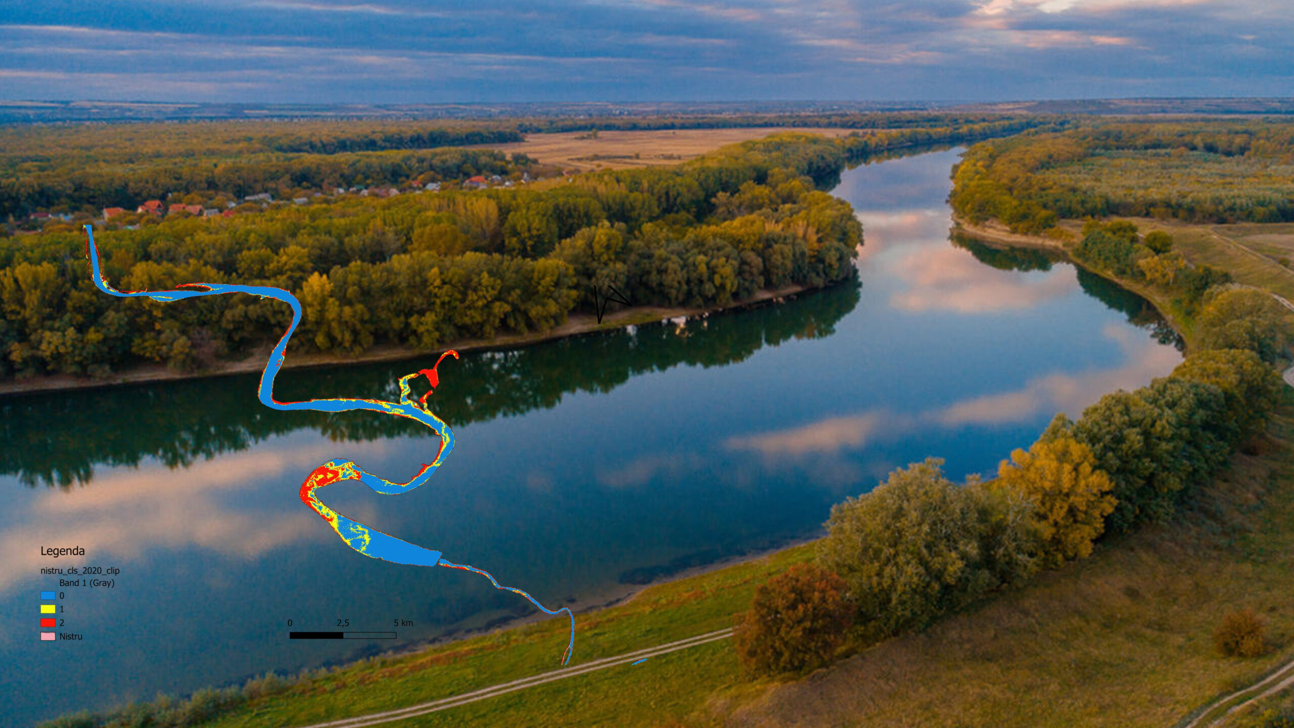
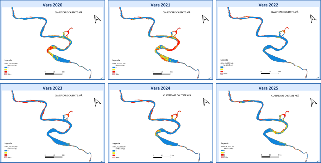
The research data cover the period 2020–2026. To assess water quality, three spectral indices were calculated. NDCI indicates the presence of chlorophyll-a, which is associated with algal growth. The turbidity index shows the amount of suspended matter in the water. NDWI helps distinguish the water surface from riverbanks, vegetation or soil.
Based on these indices, a Random Forest model was developed to classify the water into three categories: clean water, moderate turbidity, and algal bloom or anomaly.
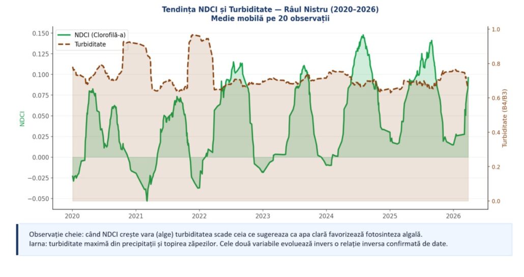
The student’s research also includes a visual component. The maps and graphs make it possible to identify areas where the water shows higher index values. These findings may indicate sections where field monitoring should be prioritised. In this way, satellite data can support the work of specialists responsible for water resources.
The proposed method responds to a real challenge: how to monitor pollution in the Dniester River more effectively. Field measurements provide direct data, while satellite imagery makes it possible to analyse the entire Moldovan section of the river at the same time. This is not only a matter of saving time. It also means comparable data, updated periodically and useful for identifying areas where changes occur.
Nichita Cătărău’s paper shows how student research can begin with a real need. Through geodesy, satellite data and machine learning, the UTM student developed a method that can support water monitoring, environmental protection and decision-making related to natural resources. Projects of this kind confirm UTM’s role in training specialists who turn technical knowledge into solutions for the environment, infrastructure and the economy of the Republic of Moldova.


